Microbursts and aviation explained
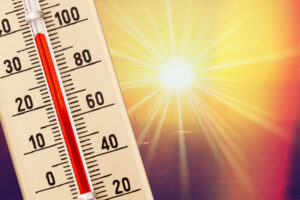
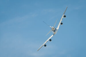
Among all weather hazards, few are as sudden and destructive as the microburst. Invisible until it’s too late, a microburst can turn a routine flight into a life-threatening emergency in seconds. These small-scale but powerful downdrafts have been responsible for some of aviation’s most devastating accidents, especially during takeoff and landing phases when aircraft are low, slow, and vulnerable.
How Microbursts Develop
A microburst occurs when a strong thunderstorm cell produces a concentrated column of descending air—essentially a “burst” of cool, dense air rushing toward the ground. When it hits the surface, it spreads out in all directions, producing sudden and severe windshear.
Typical conditions include:
- Strong thunderstorms or developing cumulonimbus clouds
- Heavy rain or virga (rain that evaporates before reaching the ground)
- Dry air aloft that accelerates downdrafts through evaporative cooling
- Short-lived but extremely intense winds—often lasting only 5–10 minutes
Within that short window, winds can shift direction and intensity by more than 40 knots, creating an impossible situation for aircraft caught unaware.
Why They’re So Dangerous
A microburst’s biggest threat is rapidly changing windshear. On approach or departure, a pilot may first encounter a headwind, causing a sudden increase in lift. Seconds later, that headwind turns into a tailwind, robbing the wings of lift and causing an abrupt sink rate. At low altitude, there’s little time or space to recover.
Notable accidents linked to microbursts include:
- Delta Air Lines Flight 191 (1985) – Crashed short of the runway in Dallas–Fort Worth after encountering a microburst on final approach.
- Eastern Air Lines Flight 66 (1975) – Lost control during approach into JFK, leading to one of the first recognized windshear-related accidents.
- USAir Flight 1016 (1994) – Crashed on approach in Charlotte, North Carolina, during a microburst event.
These tragedies reshaped training, weather detection, and pilot awareness around windshear phenomena.
Recognizing and Avoiding Microbursts
Thanks to modern forecasting and technology, pilots today have more tools than ever to detect and avoid microbursts.
Look for warning signs:
- Thunderstorm cells with heavy rain shafts or virga below the base
- Rapidly developing cumulus towers with dark, dense cores
- Gusty surface winds, dust rings, or divergent patterns visible from above
- Sudden changes in airspeed or vertical speed indicated by onboard systems
Weather reports and tools that may warn of potential microbursts:
- Terminal Doppler Weather Radar (TDWR) and Low-Level Windshear Alert Systems (LLWAS) at major airports
- METARs with remarks like “WS” for windshear alerts
- PIREPs from other pilots reporting severe downdrafts or loss of airspeed
- TAFs predicting thunderstorms or strong convective activity
Conclusion
Microbursts are short-lived but deadly, capable of overpowering even the most skilled pilot if encountered at low altitude. Understanding how they form, recognizing their warning signs, and respecting convective weather are essential parts of flight safety. Whether you’re a student pilot or an airline captain, vigilance around thunderstorms—and a healthy respect for what’s hidden inside them—will always be your best defense.
RELATED CTS TRAINING