Pilot training for aerial firefighters may add a new software system for effectiveness
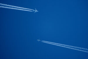
It seems like you can’t turn on the news these days without seeing a wildfire somewhere in the world. As tragic and heartbreaking as these fires are, it’s still fascinating to watch the aerial firefighters in action. The movie “Always” comes to my mind, especially the scenes of the initial pilot training for recruits – it sure seemed like it was more luck than skill in the movie, at least in the beginning. But we’ve all seen the real heroes’ videos at work, and I say their skill level is just about as high as it can be.
A company based in Portland, Oregon, is about to up the game even higher. Erickson is a company that is both an operator and manufacturer of the S-64 Air Crane heavy-lift helicopter known for providing air power to fight wildfires on a global basis. They are adding research and development to their business model as they look for more efficient and productive ways for pilots to know when and where to drop their load.
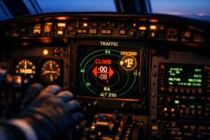
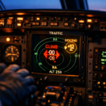
The pilots currently receive generic instructions from the air boss about what area of the fire to work. The visibility is usually poor. It’s a smoky environment, and when the trees are tall, sometimes the pilot can’t even see the fire. It’s pretty much up to the pilot to determine where to drop the water, but Erickson thinks there is a better way to do this.
The software that the senior director of R&D at Erickson, Jeff Baxter, is working on is brilliant. He and his team are developing software that will use infrared images collected from sensors mounted on an aircraft that will fly over the fire and then transmit that information in real-time to the ground below. Using GPS and computer algorithms, the software will map images of the fire and highlight the best area to drop the water.
Here’s where it gets really brilliant. The software also considers the effect of wind and terrain on the water drop, the amount of water needed to be effective for that particular location, and assigns a score to the actual drop’s effectiveness. The intent is to do two things: select water drop locations and select water drop flow rates. I didn’t even know the flow rate could be controlled. If they can automatically optimize those two things, then the pilots will have a better chance of doing their job more effectively and efficiently.
The team is ready to test the remote sensors and real-time mapping application of a fire, but they say that the system probably won’t be ready until the 2021 fire season. Ultimately, the data collected from each fire will be archived and used to help strategize the best way to fight future fires. Right now, there are no measurements made when water is dropped, so it is impossible to know how effective each drop is. Erickson wants to change that.
Baxter is also developing a tool that will help operators know which type of aircraft to dispatch for a particular fire type. All of these new developments are sure to positively affect how we fight the wildfires that are only increasing in number and severity. Pilot training will need to keep up with all of these advances in technology, but in the end, I think the entire planet will benefit from this fantastic research.
RELATED CTS TRAINING